Key Features
4 featuresCamera-Based cm-Level Positioning
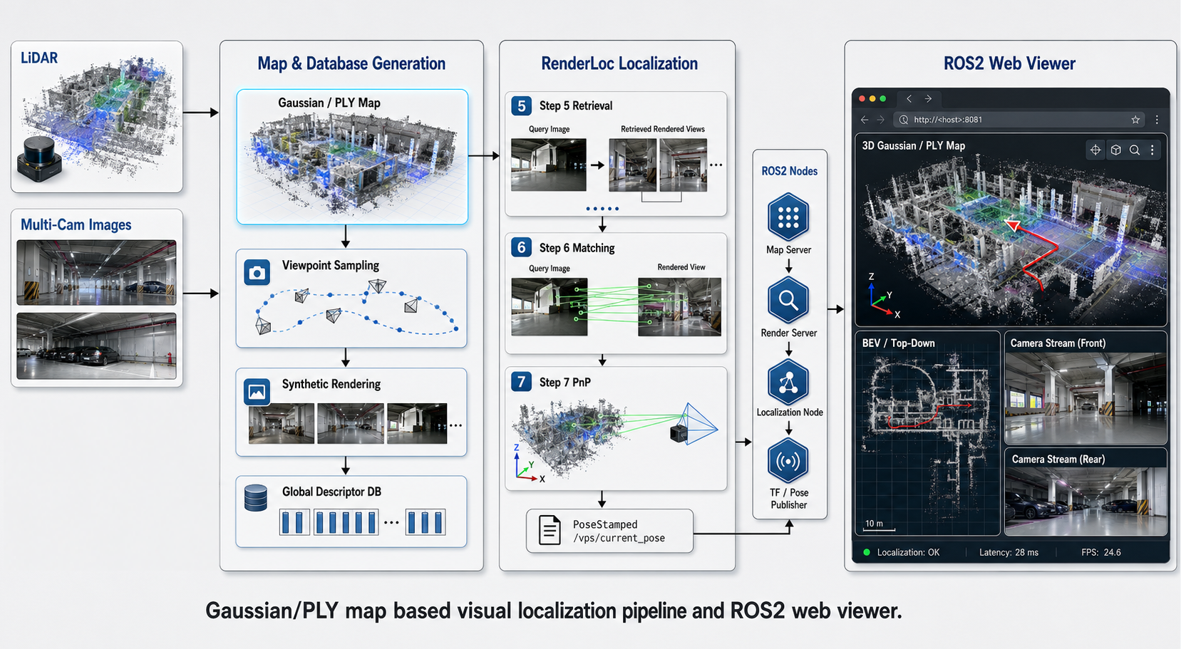
Distinguishes locations using color and texture information in repetitive structures where LiDAR cannot differentiate. Leverages the visual features of the site itself without additional QR/beacon infrastructure.
Learn more ↓AI Dual-Layer Map DB
Global Feature (place recognition, candidate extraction) → Local Feature (precise 6DoF positioning): Coarse-to-Fine structure maintains both accuracy and real-time performance even as DB size grows.
Learn more ↓Automatic Environment Change Zone Separation
Dynamically excludes feature points of changed areas from matching. Responds stably to environmental changes without map reconstruction.
Automatic LiDAR SLAM Switching/Fusion
Automatically switches to VPS or fuses two estimates when Navi-Core LiDAR SLAM reliability decreases. Achieves high availability through positioning redundancy.
Dedicated Mapping Robot: Covers Even Robot-Inaccessible Areas with Backpack Mode
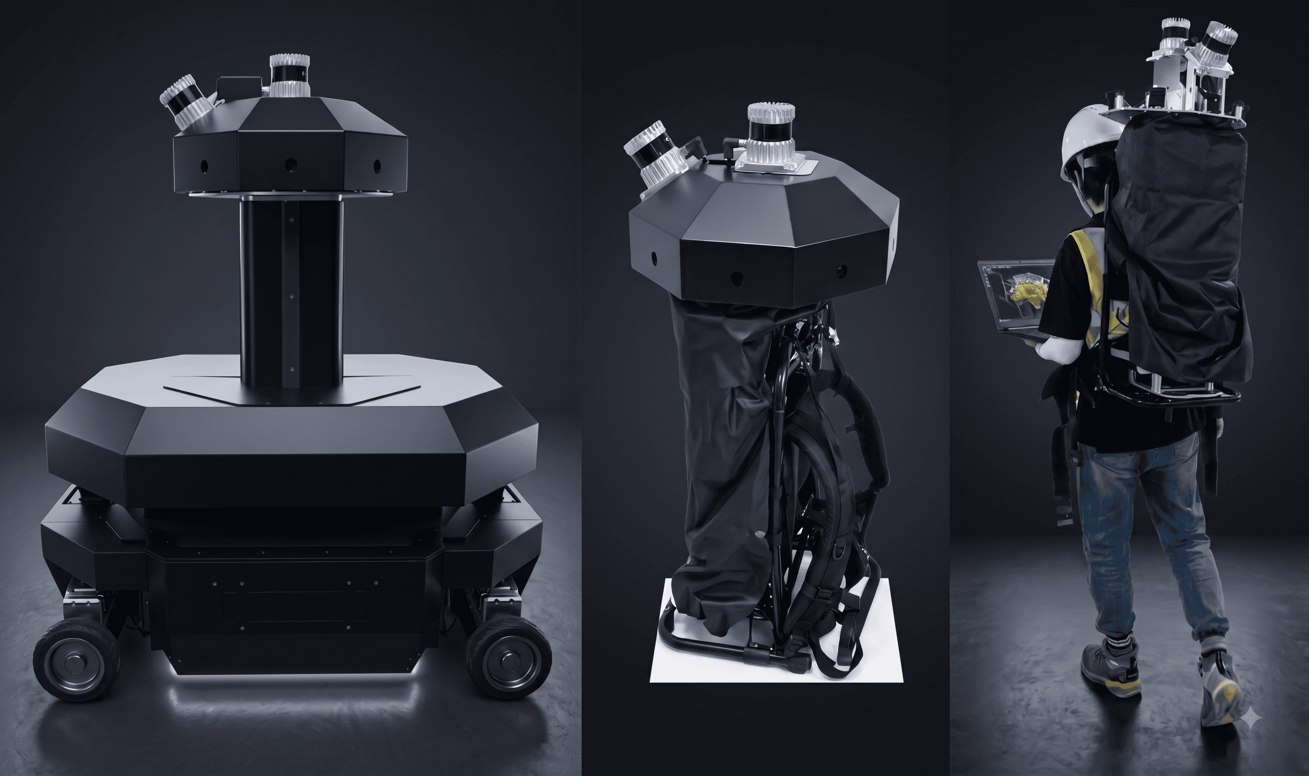
A dedicated mapping robot equipped with 8 cameras and 2 LiDARs was developed in-house. The fully detachable sensor unit switches between driving robot mount mode and backpack wear mode. The same equipment can build a map DB covering even narrow spaces, stairs, and temporary work areas inaccessible to robots.
- 8 cameras + 2 LiDARs omnidirectional high-resolution data collection
- Detachable sensor unit: dual use as driving robot mount or backpack
- DB construction even for robot-inaccessible areas with backpack mode
- AI Global+Local Feature dual-layer map DB
Covering LiDAR-Weak Environments: Glass Walls, Repetitive Corridors, Open Spaces
If zones not covered by LiDAR alone exist, those areas must be excluded from automation or require human substitute labor. Applying Navi-VPS2 allows autonomous driving to continue even in these zones with camera-based positioning, practically expanding the operational area and ROI of the automated system.
- LiDAR-weak environments: glass walls, repetitive corridors, open spaces
- Kidnap situations: immediate Re-localization via single-frame Global Feature
- Positioning redundancy → 24/7 high-availability site coverage
- Eliminates additional infrastructure costs like markers and beacons
Compatibility & Integration
A compact add-on design mounts directly on a wide range of robot platforms. Standard interfaces make it easy to connect with your existing infrastructure.
Contact Sales about Navi-VPS2
Analyze your site with our experts and design the right solution. We support you through every step, from consultation to on-site installation.